
Transport & Parking Noticeboard
Welcome to the Transport & Parking Noticeboard.
Here you will find regular updates and important information about transport & parking related schemes and projects in Hounslow.
-
NOTICEBOARD - Transport & Parking (last updated May 2026)
Share NOTICEBOARD - Transport & Parking (last updated May 2026) on Facebook Share NOTICEBOARD - Transport & Parking (last updated May 2026) on X (formerly Twitter) Share NOTICEBOARD - Transport & Parking (last updated May 2026) on Linkedin Email NOTICEBOARD - Transport & Parking (last updated May 2026) linkJUNE 2026
Bedfont Road, Feltham Traffic Calming Measures & Active Travel Improvements
Background
Hounslow Council would like to inform local residents of upcoming highway improvement works on Bedfont Road, Feltham as part of our commitment to improving road safety and encouraging walking and cycling.
The scheme is designed to enhance safety for all road users. Key improvements will focus on providing more efficient and safer vehicular movement along the corridor while also supporting better facilities for pedestrians and cyclists. The works form part of the Council’s wider programme to create safer, more accessible, and environmentally sustainable streets.
Details of the planned works
The scheme aims to make Bedfont Road safer and more accessible for everyone. Key improvements include:
✅ Speed limit reduction from 40mph to 30mph
✅ Improved Road layout and visibility, particularly at known accident locations
✅ Clearer signage and enhanced road markings.
✅ Conversion of Toucan crossing to parallel crossing at Heathrow Logistics Park.
✅ New mini roundabout at Bedfont Road / St Dunstan’s Road junction
✅ Upgraded pedestrian crossings, including:
- Heathrow Logistics Park
- Updates to crossings at Chertsey Road junction
✅ Enhanced walking and cycling facilities, including upgraded footways and shared-use paths
✅ Future provision for dedicated cycle routes
Locations of speed reduction from 40mph to 30mph:

Speed reduction measures at potentially hazardous approach to railway bridge:

Two fatal accidents and 7 serious collisions (locations below):

How to find more information:
For any queries don't hesitate to contact us via: traffic@hounslow.gov.uk (external link) using the subject line ‘Bedfont Road traffic calming’ for the attention of Nasser Abbasi , Senior Design Engineer.
What happens next?
Once the statutory notification process has been completed, details of the confirmed scheme and any decisions made will be available on the Council’s website, together with information on the anticipated delivery programme.
If you have any questions or would like further information, please contact the Transport and Parking team using the details provided below.
Your contact is: Nasser Abbasi
Contact Number: 020 8583 3322
E-mail: traffic@hounslow.gov.uk(External link)
------------------------------------------------------------------------------------------------------------
May 2026
Proposed E-bike Bay Relocation: Sherborne Road (Bedfont Ward)
Background
Officers continually monitor feedback on the e-bike scheme from residents, businesses, and Councillors. The proposed relocation of the Sherborne Road e-bike bay was prompted by a series of complaints from a local resident who noted that due to the bay’s location on a relatively narrow carriageway, any mis-parked e-bike (e.g., a bike protruding beyond the bay into the carriageway) can obstruct drivers. The resident has had trouble accessing their street, which has been particularly distressing to them due to caregiving duties for a family member requiring frequent transport to/from medical appointment.
The Sherborne Road bay forms a crucial part of the e-bike parking bay network in Bedfont – if the bay is removed without replacement, there would be a large gap in the network. This presents risks such as user dissatisfaction, reduced usage, and potential increases in abandoned e-bikes if users cannot find a suitable bay near their destination. As such, in the first instance, officers worked closely with the operators Forest and Voi to address the issue of mis-parked bikes, including a number of operator commitments. However, officers consider that a relocation may still be necessary.
We therefore reviewed the resident’s request to relocate the e-bike bay to Grovestile Waye. Officers completed an engineering review of alternative locations and recommend proceeding with the location suggested by the resident. Officers then consulted Bedfont Ward Councillors, who agreed with the proposed relocation.
What is proposed?
The existing e-bike parking bay on Sherborne Road would be removed. This space would become a shared use parking bay. A new e-bike parking bay would then be installed on Grovestile Waye, approximately 55 metres north of the existing location. The new e-bike bay would replace two existing shared use parking bays on Grovestile Waye. As such, this proposal would result in a net loss of one shared use parking bay in the area.
Download a plan drawing showing the proposed relocation
You can find the exact locations on www.what3words.com by searching:
- Existing e-bike bay location: ///horn.pile.adults
- Proposed e-bike bay location: ///magic.town.boil
How to provide feedback
The statutory consultation period opens on Friday 15 May 2026 and runs until 5 June 2026. Any comments in relation to the proposal should be received by no later than 5 June 2026.
If you are unaware, a formal (statutory) consultation is a process whereby the council advertises its proposal to introduce or amend restrictions on the public highway which, in this case, will be the proposed relocation of an e-bike parking bay. The consultation process includes notices being posted on-street, on the council’s website and in The London Gazette advising of the council’s proposal. Notices relating to the formal consultation can be viewed via Traffic notices | London Borough of Hounslow.
During the consultation, any person can submit comments (quoting the reference TMO/P020/26) in relation to the proposals and these can be submitted in writing, via the details shown at the top of this letter, or email, via trafficorders@hounslow.gov.uk
Comments can be submitted individually or as part of a wider group and any that cannot be resolved by officers will be considered by the Assistant Director of Transport and Parking in consultation with your local ward councillors and the Portfolio Holder.
What happens next?
The outcome and any decision(s) taken upon completion of the statutory consultation process will be published on the Council’s e-bike website, along with a proposed works programme.
Should you have any queries please do not hesitate to contact the team via the details shown below:
- Your contact is: PJ Bell
- Contact Number: 020 8583 3322
- E-mail: traffic@hounslow.gov.uk
- Our ref: TMO/P020/26
February 2026
 Forthcoming - Road Safety Scheme, Northumberland Avenue in Isleworth
This is to notify residents of the road safety improvements being planned on Northumberland Avenue, Isleworth in order to improve road safety for pedestrians and promote active travel in the borough.
Background
Northumberland Avenue includes an S-shaped horizontal alignment at its junction with Harewood Road.
Forward visibility for approaching and oncoming vehicles is constrained through this section, increasing the potential for vehicle conflict and, in particular, the risk of head-on collisions. Experience indicates that the existing signing arrangement has not consistently influenced driver behaviour to a level sufficient to mitigate this risk.
Further detail on what changes to expect:
The objectives of the proposed scheme are to reduce vehicle speeds through the curved section, improve driver awareness of the road geometry, and enhance safety for residents, pedestrians, and other road users. The proposals have been developed in response to local concerns regarding vehicle speed and restricted visibility along this part of Northumberland Avenue.
The attached design comprises the following key elements:
- Provision of advance advisory warning signs indicating the S-bend ahead, supported by supplementary road markings, to improve driver awareness and overall clarity of the layout.
- Removal of the existing speed cushions and replacement with a revised vertical traffic-calming feature, designed to achieve effective speed reduction in advance of the bend and adjacent junctions.
- Installation of new ‘Keep Left’ bollards on both sides of the carriageway to reinforce the intended vehicle path through the bends and improve lane discipline.
- Introduction of new ‘Give Way’ road markings and associated signage on Harewood Road at the S-bend junction, to clarify priority and improve junction safety.
Taken together, these measures are expected to moderate vehicle speeds on approach, improve driver understanding of the road layout, and reduce the likelihood of collisions. Subject to the necessary approvals the scheme will be programmed for delivery in accordance with the Council’s Road Safety Improvements programme.
-----------------------------------------------------------------------------------------------------
November 2025
Heston Road bus stop accessibility improvements - Notification
Following Transport for London’s Bus Stop Accessibility and the Department for Transport’s Inclusive Mobility guidelines, Hounslow Council is proposing to make improvements to the Heston Road bus stop 16213, serving routes 111, and 120 towards Hounslow, and as shown in attached plan.
This is to notify residents of the accessibility improvements being planned, further detail on what changes to expect are found in the table below.
For a plan of the planned improvements, please click below:
Bus stop accessibility improvements - Heston Road.
What are we proposing?
Why are we proposing it?
Reprofiling the kerb to a height of 125mm
The existing kerb height is <100mm. This is insufficient for the safe deployment of a bus ramp to enable mobility impaired users to alight/board at the stop. Kerb heights will be raised to 125mm minimum as per TfL's Bus Stop Accessibility guidelines.
Widening the footway
The existing footway is only 1.5m wide and to comply with TfL BSA guidelines, the minimum width should be 2m to accommodate space for bus passengers and pedestrians.
Our contractors Hounslow Highways will write to residents in the local area with details on confirmed dates, and work arrangements. For any queries don't hesitate to contact us via: traffic@hounslow.gov.uk using the subject line 'Heston Road Bus stop accessibility', for the attention of Abhinay Dinari.
------------------------------------------------------------------------------------------------------------------
NOVEMBER 2025
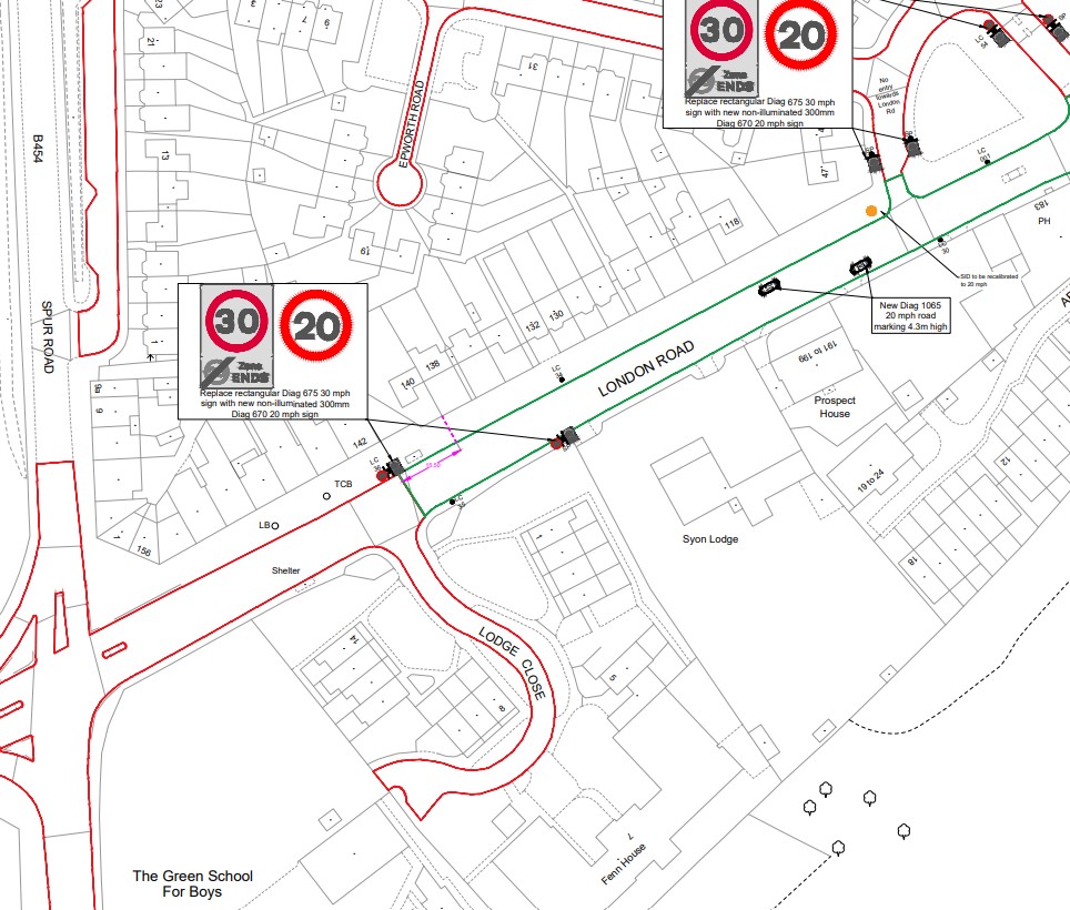
London Road - reducing the speed limit to 20mph - NotificationHounslow Council is introducing a 20mph speed limit along London Road between it's junctions with St John's Road, Isleworth and The Ham, Brentford High Street.
To support 'vision zero' (a strategy to eliminate all traffic fatalities and severe injuries), and the council's wider road safety objectives, the Council have developed plans to make this road corridor safer and more accessible for all users.
The decision to reduce the speed limit to 20mph is being taken in light of concerns raised about road safety along London Road, particularly around the Twickenham Road / Spur Road junction near to The Green School for Boys and Girls. There have been a number of recorded collisions along this stretch, and the road currently operates with a 30mph limit.
A 20mph limit is to be implemented to improve safety, encourage walking and cycling, and create a calmer and more pleasant environment for local residents. It will also bring the speed limit into line with other surrounding roads.
This is to notify residents of the road safety improvements being planned, further detail on what changes to expect are found in the links below.
2 plans are available showing details of the schemes.
Plan 1 - London Road (east section from Twickenham Road to Brentford High Street).
Plan 2 - London Road (west section from Twickenham Road to St John's Road junction)
The key objectives of introducing a 20mph speed limit:
- Reduce vehicle speeds to make the road safer for all road users, especially pedestrians and cyclists. Support 'vision zero' - helping to reduce collisions, casualties, and the risk of fatal or serious injuries.
- Promote active travel by encouraging walking and cycling in line with the borough's sustainable transport and clean air goals.
- Prioritise safety for pupils and families travelling to and from The Green School for Boys and Girls, and other nearby schools.
- Enhance the character of the area, making it a safer and more enjoyable place to live and travel.
- Provide safer routes to schools, encouraging more physical activity and healthier travel choices.
For any queries don't hesitate to contact us via: traffic@hounslow.gov.uk (external link) using the subject line 'London Road 20mph' for the atttention of Abhinay Dinari._____________________________________________________________________
NOVEMBER 2025
Wellington Road North and South - reducing the speed limit to 20mph - Notification
Hounslow council has received concerns about road safety along Wellington Road. Currently, it is 30mph, and approximately half of Wellington Road South is already 20mph near Heathland School.
We are now proposing to reduce the remaining 30mph section of Wellington Road South, to 20mph, so that both roads have a consistent speed limit.
To support 'vision zero' (a strategy to eliminate all traffic fatalities and severe injuries), and the council's wider road safety objectives, the Council have developed plans to make this road corridor safer and more accessible for all users.
The decision to reduce the speed limit to 20mph is being taken in light of concerns raised about road safety along Wellington Road. A 20mph limit is to be implemented to improve safety, encourage walking and cycling, and create a calmer and more pleasant environment for local residents. It will also bring the speed limit into line with other surrounding roads.
This is to notify residents of the road safety improvements being planned, further detail on what changes to expect are found in the link below.
Please click here to view a plan showing details of the scheme: Wellington Road - 20mph plan
The key objectives of introducing a 20mph speed limit:
- Reduce vehicle speeds to make the road safer for all road users, especially pedestrians and cyclists. Support 'vision zero' - helping to reduce collisions, casualties, and the risk of fatal or serious injuries.
- Promote active travel by encouraging walking and cycling in line with the borough's sustainable transport and clean air goals.
- Prioritise safety for pupils and families travelling to and from schools.
- Enhance the character of the area, making it a safer and more enjoyable place to live and travel.
- Provide safer routes to schools, encouraging more physical activity and healthier travel choices.
For any queries don't hesitate to contact us via: traffic@hounslow.gov.uk (external link) using the subject line 'Wellington Road 20mph' for the atttention of Abhinay Dinari.----------------------------------------------------------------------------------------------
NOVEMBER 2025
Sutton Lane, Hounslow - traffic calming and road safety improvements - Notification
Hounslow council will be upgrading zebra crossings and improving pedestrian safety along Sutton Lane, Hounslow (A3063).
This is to notify residents of the road safety improvements being planned on Sutton Lane, Hounslow, in order to improve road safety for pedestrians and promote active travel in the borough. Further detail on what changes to expect are found in the links below.
Detail on the improvements we are planning to deliver:
Road name Proposed improvements Sutton Lane, Hounslow (A3063) Upgrade the existing zebra crossing near to the junction with Bulstrode Avenue. Sutton Lane, Hounslow (A3063) Upgrade the existing zebra crossing near the junction with Harte Road. Sutton Lane, Hounslow (A3063) Proposed electronic speed warning sign, near Sarsen Avenue Speed table upgrades: The existing zebra crossings near 42 Sutton Lane (close to Bulstrode Avenue) and 65 Sutton Lane (near Harte Road) will be placed on 'speed tables' to reduce vehicle speeds and act as traffic calming measures.
Accessibility improvements: These changes will make crossing easier and safer for wheelchair users, pushchair users, and other vulnerable road users.
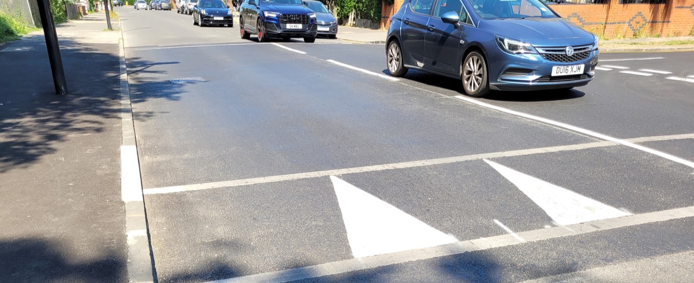
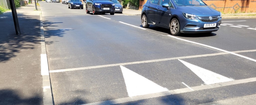
For information, a speed table has a flat top (usually 3–6 meters long) and gently sloped ramps on both ends. This makes it more comfortable for vehicles to cross at low speeds compared to a sharp hump. An example of a speed table is shown below:
Plans of the proposals - plans can be viewed by clicking on the following links:
Plan 1 - plan showing the changes to be made to the Zebra crossing near to Bulstrode Avenue.
Plan 2 - Plan showing the changes to be made to the Zebra crossing near Harte Road.
Plan 3 - Plan showing where the electronic speed warning sign will be installed (near to Sarsen Avenue)
Example of a 'speed table'
Why are we planning to make these changes?
Sutton Lane currently has a 20 mph speed limit, which is often not fully adhered to by drivers. Therefore, placing the existing zebra crossings near to 42 Sutton Lane (close to the junction with Bulstrode Avenue) and at 65 Sutton Lane (near Harte Road) onto a 'speed table' will also help reduce speeds and act as a traffic calming measure. This will also enhance safety for wheelchair users, pushchair users, and other vulnerable road users by making it easier to cross the road.
These planned improvements respond to longstanding requests from residents expressing safety concerns, supported by records of personal injury accidents (PIA's) along Sutton Lane, and form part of a wider 3-year initiative called Community Led Schemes (CLS), which focuses on local traffic improvements informed by feedback from Hounslow residents, businesses, and ward/local councillors.
For any queries don't hesitate to contact us via: traffic@hounslow.gov.uk (external link) using the subject line 'Sutton Lane CLS' for the attention of Harji Hirani, Senior Highways Engineer.
